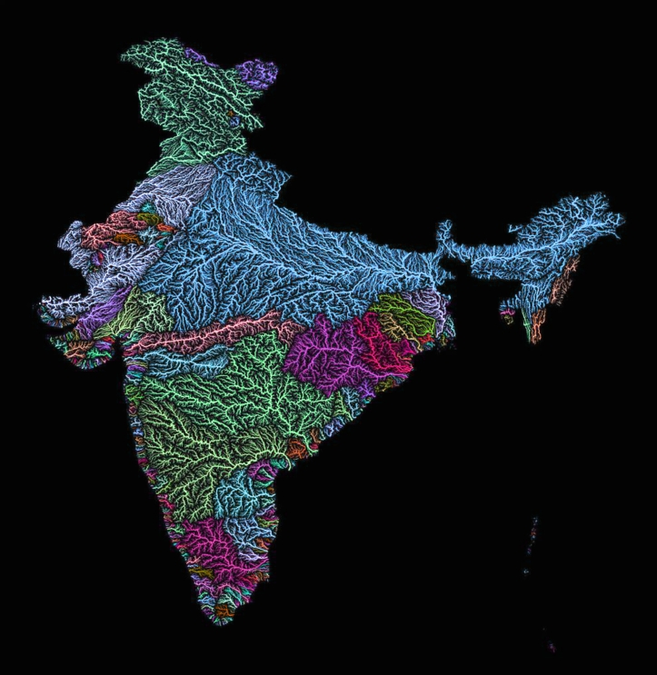
Maps as art: The veins of the world, Africa, Australia, Europe, South America, Great Britain, China, India, Mexico the United States, and California. Rivers and river basins visualized by Hungarian geographer Robert Szucs.
“Rivers are amazing. I worked a lot with spatial data during my studies in geography and GIS, and you just see what nature can draw is incredible. Still, all the river maps you see look the same, boring, unspectacular. All lines blue, all the same width. It’s quite amazing how you can make such bad maps from such great source material.”


awsome work
LikeLike
sick
LikeLike
These are gorgeous, I’m a Geography teacher and would love some of these in my class room, are there any higer resolution versions that would still look good when blown p to poster size? Say, 61x91cm. Particularly the large contientents/world map
Thanks
LikeLike
This is so cool! My boyfriend’s 30th birthday is coming up and he is an absolute river rat and would LOVE this. Do you have the North American watershed in 31x38in pdf?
Thank you, Joanna
LikeLike
[…] Bacias Hidrográficas da América do Sul. Fonte: The Decolonial Atlas. […]
LikeLike
[…] Colorful River Basin Maps | The Decolonial Atlas. Maps as art: The veins of Africa, Australia, Europe, South America, China, India, Mexico the United States, and California. Rivers and river basins visualized by Hungarian geographer Robert Szucs. “Rivers are amazing. I worked a lot with spatial data during my studies in geography and GIS, and you just see what nature can draw is incredible. Still, all the river maps you see look the same, boring, unspectacular. […]
LikeLike
One more design the actual reason in popularity is which the professional graphic unit.
Plan the paying for the bridesmaid dress, accomplish in better.
Don’t skip the preliminary work before you venture out. http://www.rceppacat.com/ways-to-keep-your-gaming-growing-without-burning-the-midnight-oil/
LikeLike
How come I see river maps and basins in desert areas of Africa and Australia?
LikeLike
[…] beautiful satellite maps coloured to depict the world’s river networks Especially love the Africa […]
LikeLike
Great work. Canada next!
LikeLike
These river maps are amazing.
If they are all the same colour, do they connect to just one river?
LikeLike
Can we see New Zealand, please?
LikeLiked by 1 person
Yes, please Aotearoa. We’d really like this.
LikeLiked by 1 person
Awesome! You should do Alaska 🙂
LikeLike
Great work! And then you can do some spatial analysis re: catchment size vs agricultural output! Maybe overlay nation-state borders as well…
LikeLike
Awesome. Thank you.
LikeLike